Radkov (district de Tábor) Géographie | Histoire | Notes et références | Menu de navigationSite officielmodifierRadkovPopulation des communes de la République tchèque au 1er janvier 2017geoportal.gov.czmm
Commune du district de Tábor
projets correspondantsallemandcommunedistrict de Táborrégion de Bohême-du-SudRépublique tchèque2017TáborČeské BudějovicePragueBorotínChotovinyRadimovice u TáboraNasavrkySvrabovBalkova LhotaJistebnice1419
Cet article est une ébauche concernant la République tchèque.
Vous pouvez partager vos connaissances en l’améliorant (comment ?) selon les recommandations des projets correspondants.
| Radkov.mw-parser-output .entete.mapbackground-image:url("//upload.wikimedia.org/wikipedia/commons/7/7a/Picto_infobox_map.png") | |||
 | |||
| Administration | |||
|---|---|---|---|
Pays | |||
Région | |||
District | Tábor | ||
Région historique | Bohême | ||
Maire | Tomáš Bálek | ||
Code postal | 391 31 | ||
| Démographie | |||
Population | 169 hab. (2017) | ||
| Densité | 31 hab./km2 | ||
| Géographie | |||
Coordonnées | 49° 27′ 57″ nord, 14° 36′ 50″ est | ||
Altitude | 519 m | ||
Superficie | 538 ha = 5,38 km2 | ||
| Localisation | |||
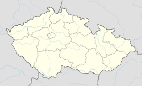
| Géolocalisation sur la carte : République tchèque
Géolocalisation sur la carte : République tchèque
| |||
| Liens | |||
Site web | Site officiel | ||
modifier | |||

Radkov (en allemand : Radkow) est une commune du district de Tábor, dans la région de Bohême-du-Sud, en République tchèque. Sa population s'élevait à 169 habitants en 2017[1].
Géographie |
Radkov se trouve à 8 km au nord-ouest de Tábor, à 56 km au nord-nord-est de České Budějovice et à 70 km au sud-sud-est de Prague[2].
La commune est limitée par Borotín au nord, par Chotoviny et Radimovice u Tábora à l'est, par Nasavrky, Svrabov et Balkova Lhota au sud, et par Jistebnice à l'ouest[3].
Histoire |
La première mention écrite du village date de 1419.
Notes et références |
.mw-parser-output .autres-projets ulmargin:0;padding:0.mw-parser-output .autres-projets lilist-style-type:none;list-style-image:none;margin:0.2em 0;text-indent:0;padding-left:24px;min-height:20px;text-align:left.mw-parser-output .autres-projets .titretext-align:center;margin:0.2em 0.mw-parser-output .autres-projets li afont-style:italic
(cs) Population des communes de la République tchèque au 1er janvier 2017.
Distances à vol d'oiseau ou distances orthodromiques.
D'après geoportal.gov.cz.
 Portail de la République tchèque


